


ARAVIS: LES CONFINS _ TROU DE LA MOUCHE

djeepee74
User
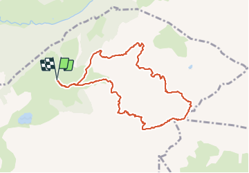

Length
9.8 km

Max alt
2440 m

Uphill gradient
1015 m
Km-Effort
23 km

Min alt
1441 m

Downhill gradient
1015 m
Boucle
Yes
Creation date :
2021-08-15 04:57:51.577
Updated on :
2021-08-19 14:01:49.504
6h15
Difficulty : Difficult

FREE GPS app for hiking
 SityTrail
IGN / Geographical institutes
SityTrail Plus
The world is yours!
About
Trail Walking of 9.8 km to be discovered at Auvergne-Rhône-Alpes, Upper Savoy, La Clusaz. This trail is proposed by djeepee74.
Description
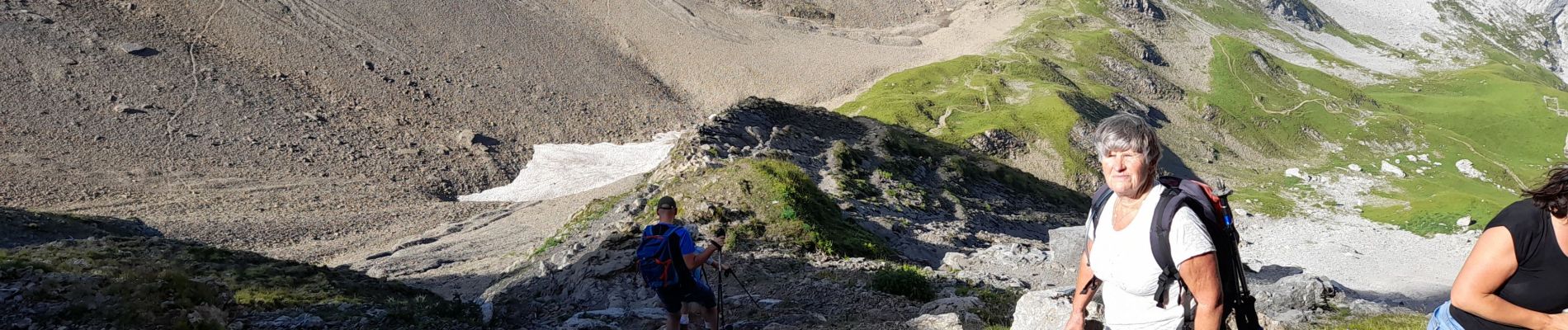
BOUCLE... live 20210815
Montée par la Combe de Paccaly... Descente par la Combe du Grand Crêt.
La montée du passage du Père ne pose pas de difficultés particulières par temps sec.
Photos


Positioning
Country:
France
Region :
Auvergne-Rhône-Alpes
Department/Province :
Upper Savoy
Municipality :
La Clusaz
Location:
Unknown
Start:(Dec)
Start:(UTM)
304903 ; 5088516 (32T) N.
Comments